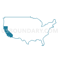
Santa Clara County (Northwest)--Mountain View, Palo Alto & Los Altos Cities PUMA, California
About
Outline
--Mountain+View%2c+Palo+Alto+%26+Los+Altos+Cities+PUMA%2c+California_A280.png)
Summary
| Unique Area Identifier | 192436 |
| Name | Santa Clara County (Northwest)--Mountain View, Palo Alto & Los Altos Cities PUMA |
| State | California |
| Area (square miles) | 99.48 |
| Land Area (square miles) | 95.89 |
| Water Area (square miles) | 3.59 |
| % of Land Area | 96.39 |
| % of Water Area | 3.61 |
| Latitude of the Internal Point | 37.36084110 |
| Longtitude of the Internal Point | -122.11345370 |
Maps
--Mountain+View%2c+Palo+Alto+%26+Los+Altos+Cities+PUMA in California.png)
Santa Clara County (Northwest)--Mountain View, Palo Alto & Los Altos Cities PUMA in California
Download
Graphs
Select a template below for downloading or customizing gragh for Santa Clara County (Northwest)--Mountain View, Palo Alto & Los Altos Cities PUMA, California
--Mountain+View%2c+Palo+Alto+%26+Los+Altos+Cities+PUMA%2c+California_T0.png)
--Mountain+View%2c+Palo+Alto+%26+Los+Altos+Cities+PUMA%2c+California_T1.png)
--Mountain+View%2c+Palo+Alto+%26+Los+Altos+Cities+PUMA%2c+California_T2.png)
--Mountain+View%2c+Palo+Alto+%26+Los+Altos+Cities+PUMA%2c+California_T3.png)
--Mountain+View%2c+Palo+Alto+%26+Los+Altos+Cities+PUMA%2c+California_T4.png)
--Mountain+View%2c+Palo+Alto+%26+Los+Altos+Cities+PUMA%2c+California_T5.png)
--Mountain+View%2c+Palo+Alto+%26+Los+Altos+Cities+PUMA%2c+California_T6.png)
--Mountain+View%2c+Palo+Alto+%26+Los+Altos+Cities+PUMA%2c+California_T7.png)
Neighbors
Neighoring Public Use Microdata Area (by Name) Neighboring Public Use Microdata Area on the Map
- Alameda County (West)--San Leandro, Alameda & Oakland (Southwest) Cities PUMA, CA
- San Mateo County (South & West)--San Mateo (South) & Half Moon Bay Cities PUMA, CA
- San Mateo County (Southeast)--Menlo Park, East Palo Alto Cities & Atherton Town PUMA, CA
- Santa Clara County (Northwest)--Sunnyvale & San Jose (North) Cities PUMA, CA
- Santa Clara County (Southwest)--Cupertino, Saratoga Cities & Los Gatos Town PUMA, CA
- Santa Cruz County (North)--Watsonville & Scotts Valley Cities PUMA, CA
Top 10 Neighboring County (by Population) Neighboring County on the Map
- Santa Clara County, CA (1,781,642)
- Alameda County, CA (1,510,271)
- San Mateo County, CA (718,451)
- Santa Cruz County, CA (262,382)
Top 10 Neighboring County Subdivision (by Population) Neighboring County Subdivision on the Map
- San Jose CCD, Santa Clara County, CA (1,661,105)
- San Mateo CCD, San Mateo County, CA (383,442)
- Fremont CCD, Alameda County, CA (325,166)
- Half Moon Bay CCD, San Mateo County, CA (28,894)
- San Lorenzo Valley CCD, Santa Cruz County, CA (23,195)
- West Santa Clara CCD, Santa Clara County, CA (7,529)
- Lexington Hills CCD, Santa Clara County, CA (4,009)
Top 10 Neighboring Place (by Population) Neighboring Place on the Map
- Fremont city, CA (214,089)
- Sunnyvale city, CA (140,081)
- Mountain View city, CA (74,066)
- Palo Alto city, CA (64,403)
- Cupertino city, CA (58,302)
- Menlo Park city, CA (32,026)
- Saratoga city, CA (29,926)
- Los Altos city, CA (28,976)
- East Palo Alto city, CA (28,155)
- Stanford CDP, CA (13,809)
Top 10 Neighboring Elementary School District (by Population) Neighboring Elementary School District on the Map
- Cupertino Union Elementary School District, CA (138,600)
- Sunnyvale Elementary School District, CA (85,145)
- Mountain View Whisman Elementary School District, CA (65,635)
- Los Altos Elementary School District, CA (40,653)
- Ravenswood City Elementary School District, CA (34,992)
- Los Gatos Union Elementary School District, CA (27,174)
- Menlo Park City Elementary School District, CA (25,996)
- Saratoga Union Elementary School District, CA (19,679)
- Las Lomitas Elementary School District, CA (11,354)
- Portola Valley Elementary School District, CA (6,479)
Top 10 Neighboring Secondary School District (by Population) Neighboring Secondary School District on the Map
- Sequoia Union High School District, CA (243,514)
- Fremont Union High School District, CA (223,745)
- Mountain View-Los Altos Union School District, CA (106,288)
- Los Gatos-Saratoga Joint Union School District, CA (53,209)
Top 10 Neighboring Unified School District (by Population) Neighboring Unified School District on the Map
- Fremont Unified School District, CA (214,089)
- Palo Alto Unified School District, CA (80,606)
- La Honda-Pescadero Unified School District, CA (3,464)
Top 10 Neighboring State Legislative District Lower Chamber (by Population) Neighboring State Legislative District Lower Chamber on the Map
- Assembly District 22, CA (463,391)
- Assembly District 20, CA (445,046)
- Assembly District 24, CA (442,181)
- Assembly District 19, CA (433,645)
- Assembly District 21, CA (432,366)
- Assembly District 27, CA (424,862)
Top 10 Neighboring State Legislative District Upper Chamber (by Population) Neighboring State Legislative District Upper Chamber on the Map
- State Senate District 15, CA (903,066)
- State Senate District 13, CA (895,425)
- State Senate District 10, CA (893,839)
- State Senate District 11, CA (876,710)
- State Senate District 8, CA (863,255)
Top 10 Neighboring 111th Congressional District (by Population) Neighboring 111th Congressional District on the Map
- Congressional District 15, CA (677,605)
- Congressional District 13, CA (665,318)
- Congressional District 14, CA (653,935)
Top 10 Neighboring Census Tract (by Population) Neighboring Census Tract on the Map
- Census Tract 6119, San Mateo County, CA (10,325)
- Census Tract 5130, Santa Clara County, CA (8,215)
- Census Tract 5077.03, Santa Clara County, CA (7,706)
- Census Tract 5115, Santa Clara County, CA (7,513)
- Census Tract 6121, San Mateo County, CA (7,041)
- Census Tract 5084.01, Santa Clara County, CA (6,834)
- Census Tract 6132, San Mateo County, CA (6,494)
- Census Tract 5110, Santa Clara County, CA (6,402)
- Census Tract 5091.05, Santa Clara County, CA (6,396)
- Census Tract 5106, Santa Clara County, CA (6,139)
Top 10 Neighboring 5-Digit ZIP Code Tabulation Area (by Population) Neighboring 5-Digit ZIP Code Tabulation Area on the Map
- 95014, CA (60,717)
- 94087, CA (54,293)
- 94086, CA (45,697)
- 94303, CA (45,467)
- 94025, CA (40,526)
- 94040, CA (32,996)
- 95070, CA (30,617)
- 94043, CA (28,358)
- 94306, CA (26,469)
- 94062, CA (25,876)


--Mountain+View%2c+Palo+Alto+%26+Los+Altos+Cities+PUMA%2c+California.png)